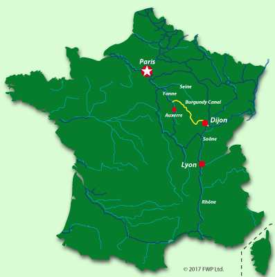
The Burgundy Canal is located in central-eastern France in the region of Bourgogne-Franche-Comté. The French call the canal “Le Canal de Bourgogne.”
The canal spans the two eastern counties ("departments") of the Yonne and the Côte d’Or for more than 200 kilometres, winding its way through small towns, villages, and valleys. The most important city along the canal is Dijon, which is also the region's capital, Bourgogne-Franche-Comté.
Travelling to the canal via road is relatively easy, with nearby autoroutes from Mulhouse, Lyon, Paris, and Reims. Using the trains, you have high-speed TGV access to Dijon and Montbard, from Paris, Lausanne, and Geneva.
The map below outlines Burgundy and shows the canal crossing it from the northwest to the southeast.
Click here for more maps of the region. More information and dates about the Burgundy Canal
Other canals in Burgundy
The region also has three other important canals: the Canaux du Centre, the Canal du Nivernais, and the Canal Bourgogne-Champagne (formerly called the Canal Marne à la Saône).
Canaux du Centre
The “Canaux du Centre” is a network of five canals that connect the river Seine at Sainte Mammes, north of Paris, to the river Saône at Chalon-sur-Saône in the south, crossing the centre of France; hence the name. The canal still has significant commercial traffic, with barges up to 38 metres long, and the locks are built to the Freycinet standard. The names of the canals making the Canaux du Centre :
- Canal du Loing
- Canal du Briard
- Canal lateral à la Loire
- Canalde Roanne à Digoin
- Canal du Centre
Canal du Nivernais
The Canal du Nivernais connects the river Yonne in the town of Auxerre in the north and then joins the Canal du Centre to the south at Decize via a small navigable section of the river Loire. The canal is very pretty but reserved for barges of less than 30 metres in length.
Canal Bourgogne-Champagne
The Canal de la Marne à la Saône has recently changed its name to the Canal Bourgogne-Champagne. Commercial barges still use the canal and connect the River Marne at Vitry-le-François north to the River Saône south at Heuilly-sur-Saône. Built to Freycinet standards, barges up to 38 metres can navigate the canal. The canal spans 224 kilometres with a total of 114 locks.
The main navigable rivers in Burgundy
With all the canals, there are, of course, rivers connected via the canals. In the north, you have access to the river Seine, via the River Loing to the Canaux du Centre, and the River Yonne via the Burgundy Canal. In the south, the canals join the River Saone with access to the beautiful River Doubs.
The Saône
The river connects the Alsace Canal (Canal de l’Est) at Corre to the river Rhone at Lyon. Essential commercial traffic involves barges up to 185 metres long. While the river is fairly narrow and curved upstream, it becomes wide as you approach Saint-Jean-de-Losne. It passes through important towns such as Chalon-sur-Saône and Mâcon before joining the River Rhône at Lyon.
The River Doubs
The River Doubs (Canal du Rhône au Rhin) connects the Saone at Saint Jean de Losne and the Rhone to the Rhine at Mulhouse. As you cruise, you’ll alternate between canal and river. There are two tunnels, one at Besançon and the other at Thoraise. The Doubs is famous for its instability and rapid water level rise.
The River Yonne
The River Yonne has its source at Glux-en-Glenne in the Nièvre department, not too far from the archaeological site of the Gallic town of Bibracte. It flows northwards and is joined by the Canal du Nivernais, the water then flows through the city of Auxerre and into the River Seine. The Yonne is more than 290 kilometres long, and 108 kilometres of it are navigable.
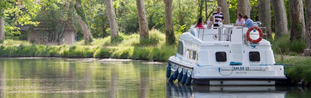
The waterways allow boats and barges to navigate the country, offering hundreds of miles of canals and rivers to explore.
Have fun.