Maps of the Burgundy canal
Burgundy Canal maps
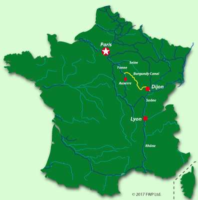
A view of the canal's geographical location in France is marked in yellow
The above map shows the position of the Burgundy Canal, the rivers Saône, Yonne, Seine and Loire plus some of the other nearby canals
The Yonne region and the Northern section of the canal
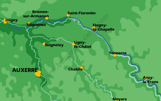
This is the northern section of the Burgundy Canal. The canal flows from the southeast to the northwest and empties into the River Yonne at Mignennes. The river Yonne flows into the river Seine.
The central northern section of the canal
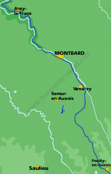
This is the central section of the Burgundy Canal on the northern side, the town of Pouilly-en-Auxois being at the summit. The river Armonçon flows laterally alongside the canal feeding and storing water where necessary. You will also notice the towns of Montbard and the historical town of Semur en Auxois.
The Saône section of the canal
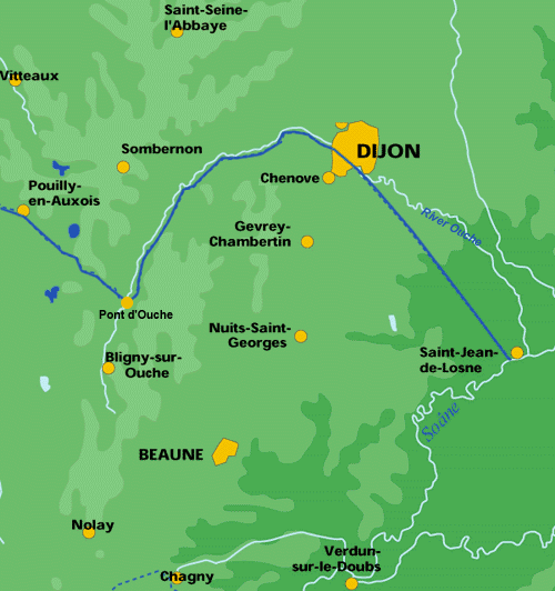
This is the southern part of the Burgundy Canal, the water flows southeast and downstream from Pouilly en Auxois, through Dijon, to the river Saône. The River Ouche flows through the market town of Bligny-sur-Ouche and joins the canal at Pont d’Ouche. The Ouche then follows the canal down to the River Saône, water from the River Ouche is used to compensate the water supply for the canal.
The canal empties into the River Saone at Saint Jean de Losne, whilst the river Ouche joins the River Saone just a few miles to the north of Saint Jean de Losne.
The Saône River flows south and joins the River Rhone in the centre of the city of Lyon.
Cruise navigation maps of the Burgundy Canal
To order a detailed map suitable for self-drive boat rentals, barge cruising and even cycling, please contact Emma at Hotelsafloat.com
